Back chapter figures
Figure 1.18
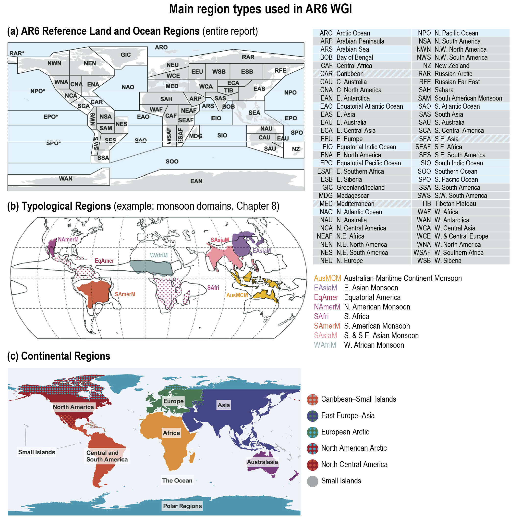
Figure caption
Figure 1.18 | Main region types used in this report. (a) AR6 WGI Reference Set of Land and Ocean Regions (Iturbide et al., 2020), consisting of 46 land regions and 15 ocean regions, including 3 hybrid regions (CAR, MED, SEA) that are both land and ocean regions. Abbreviations are explained to the right of the map. Notice that RAR, SPO, NPO and EPO extend beyond the 180º meridian, therefore appearing at both sides of the map (indicated by dashed lines). A comparison with the previous reference regions of AR5 WGI (IPCC, 2013a) is presented in the Atlas. (b) Example of typological regions: monsoon domains (see Chapter 8). Abbreviations are explained to the right of the map. The black contour lines represent the global monsoon zones, while the coloured regions denote the regional monsoon domains. The two stippled regions (EqAmer and SAfri) do receive seasonal rainfall, but their classification as monsoon regions is still under discussion. (c) Continental Regions used mainly in Chapter 12 and the Atlas. Stippled zones define areas that are assessed in both regions (e.g., the Caribbean is assessed as Small Islands and also as part of Central America). Small Islands are ocean regions containing small islands with consistent climate signals and/or climatological coherence.