Back chapter figures
Figure 1.19
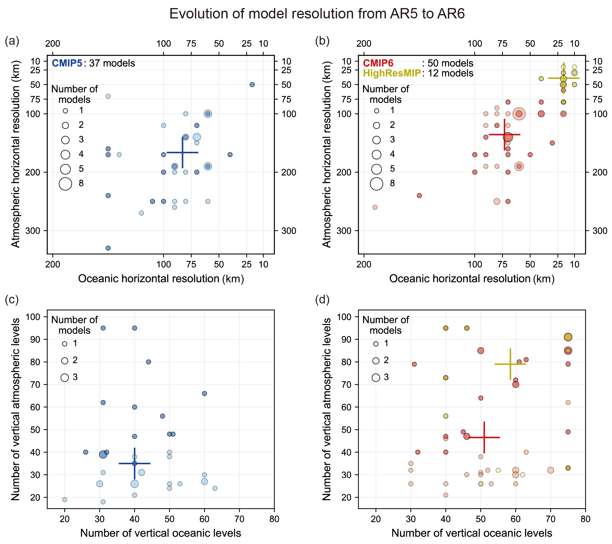
Figure caption
Figure 1.19 | Resolution of the atmospheric and oceanic components of global climate models participating in CMIP5, CMIP6 and HighResMIP: (a, b) horizontal resolution (km), and (c, d) number of vertical levels. Darker-colour circles indicate high-top models (in which the top of the atmosphere is above 50 km). The crosses are the median values. These models are documented in Annex II. Note that duplicated models in a modelling group are counted as one entry when their horizontal and vertical resolutions are the same. For HighResMIP, one atmosphere–ocean coupled model with the highest resolution from each modelling group is used. The horizontal resolution (rounded to 10 km) is the square root of the surface area of the Earth divided by the number of grid points, or the area of the ocean surface divided by the number of surface ocean grid points, for the atmosphere and ocean, respectively.