Back chapter figures
Figure 11.19
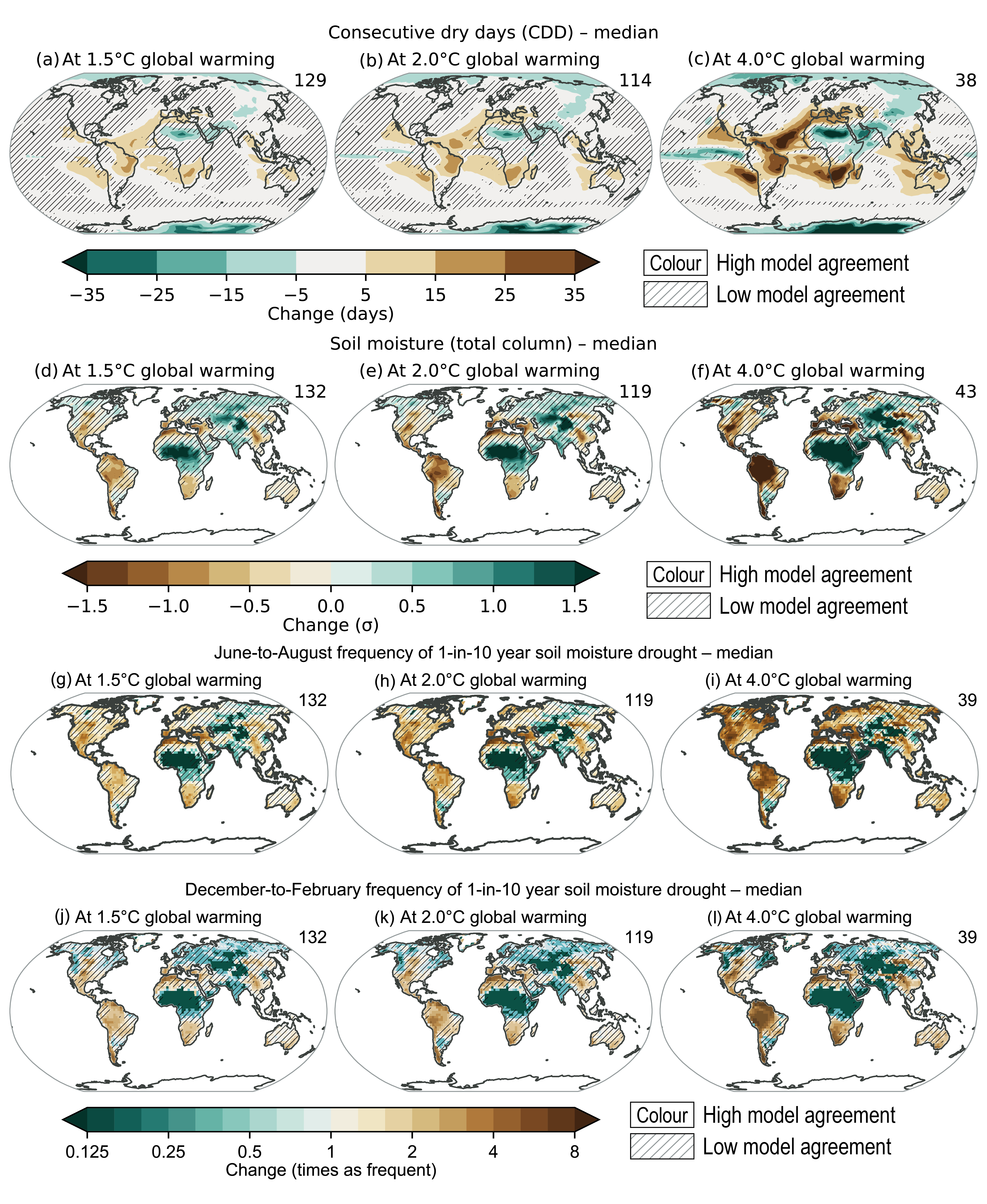
Figure caption
Figure 11.20 | Summary schematic of past and projected changes in tropical cyclone (TC), extratropical cyclone (ETC), atmospheric river (AR), and severe convective storm (SCS) behaviour. Global changes (blue shading) from top to bottom: (i) Increased mean and maximum rain rates in TCs, ETCs, and ARs [past (low confidence due to lack of reliable data) and projected (high confidence)]; (ii) Increased proportion of stronger TCs [past (medium confidence) and projected (high confidence)]; (iii) Decrease or no change in global frequency of TC genesis [past (low confidence due to lack of reliable data) and projected (medium confidence)]; and (iv) Increased and decreased ETC wind speed, depending on the region, as storm tracks change [past (low confidence due to lack of reliable data) and projected (medium confidence)]. Regional changes, from left to right: (i) Poleward TC migration in the western North Pacific and subsequent changes in TC exposure [past (medium confidence) and projected (medium confidence)]; (ii) Slowdown of TC forward translation speed over the contiguous USA and subsequent increase in TC rainfall [past (medium confidence) and projected (low confidence due to lack of directed studies)]; and (iii) Increase in mean and maximum SCS rain rate and increase in spring SCS frequency and season length over the contiguous USA [past (low confidence due to lack of reliable data) and projected (medium confidence)].