Back chapter figures
Figure 15.3
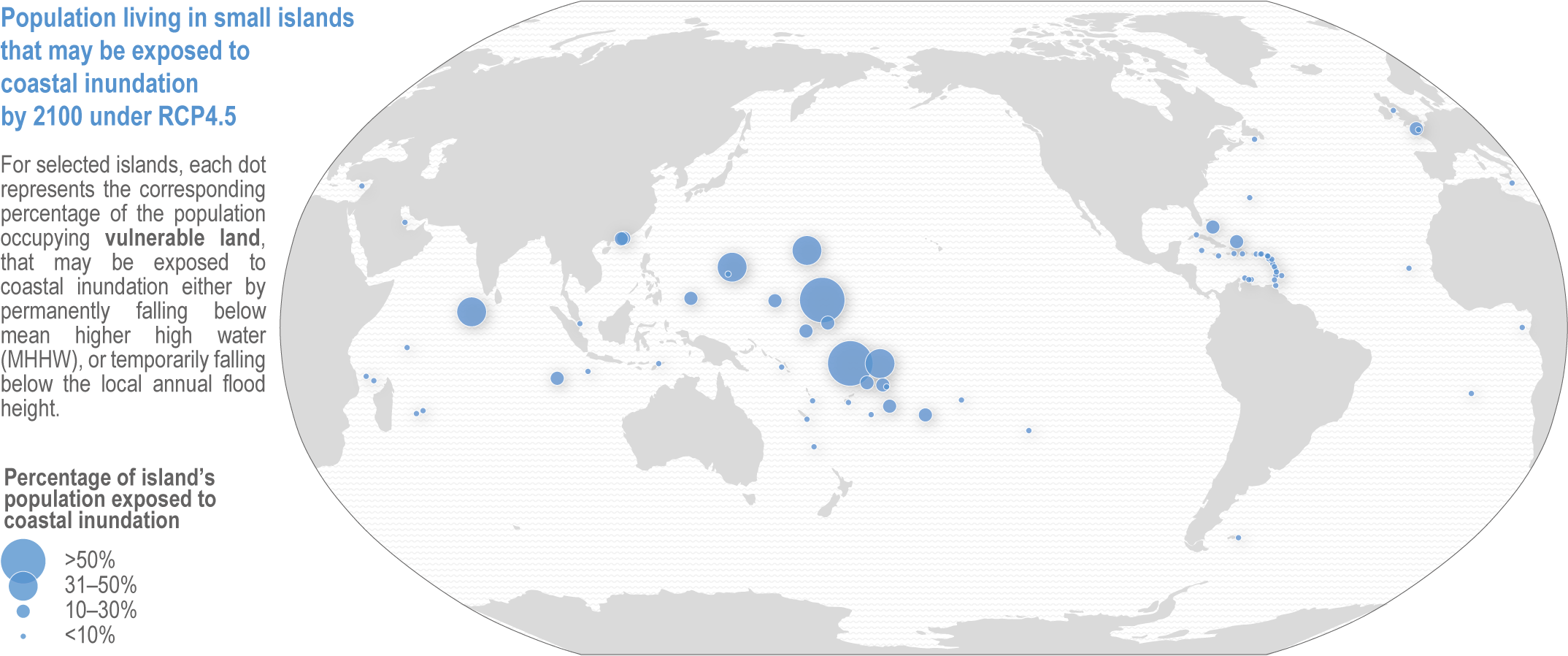
Figure caption
Figure 15.3 | Percentage of current population in selected small islands occupying vulnerable land (the number of people on land that may be exposed to coastal inundation—either by permanently falling below MHHW, or temporarily falling below the local annual flood height) in 2100 under an RCP4.5 scenario (adapted from Kulp and Strauss, 2019, using the CoastalDEM_Perm_p50 model). Positions on the map are based on the capital city or largest town.