Figure 2.3
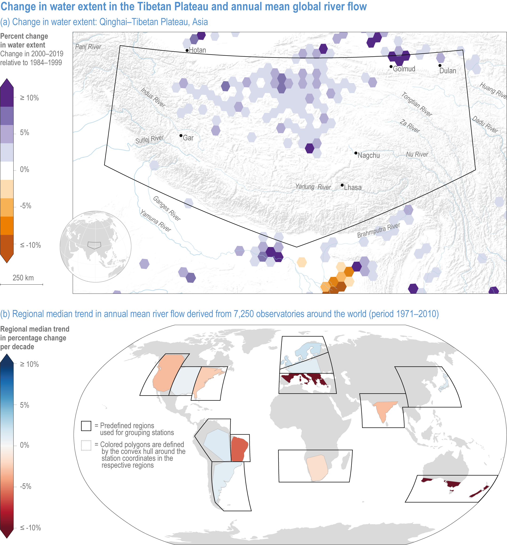
Figure caption
Figure 2.3 | Change in water extent in the Tibetan Plateau and annual mean global river flow.
(a) Changes in water storage on the Tibetan Plateau. Map of the Qinghai–Tibetan Plateau, Asia, showing the percent change in surface water extent from 1984 to 2019 based on LANDSAT imagery. Increases in surface water extent in this region are mainly caused by climate change-mediated increases in precipitation and glacial melt (Source: EC JRC/Google; (Pekel et al., 2016).
(b) Global map of the median trend in annual mean river flow derived from 7250 observatories around the world (in 1971–2010). Some regions are drying (northeast Brazil, southern Australia and the Mediterranean) and others are wetting (northern Europe), mainly caused by large-scale shifts in precipitation, changes in factors that influence evapotranspiration and alterations of the timing of snow accumulation and melt driven by rising temperatures (Source: (Gudmundsson et al., 2021).