Back chapter figures
Figure 4.4
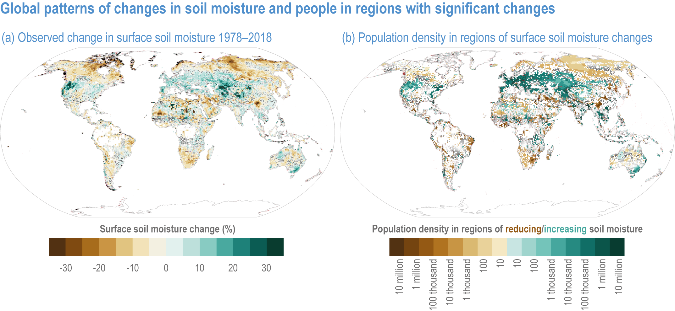
Figure caption
(a) Percentage changes in annual mean surface soil moisture (0–5 cm) for 1978–2018 from satellite remote sensing: the “COMBINED” product of European Space Agency Climate Change Initiative Soil Moisture (ESA CCI SM v03.2), which blends data products from two microwave instruments, a scatterometer measuring radar backscattering and a radiometer measuring brightness temperature (van der Schalie et al., 2021).
(b) The population density in 0.25° grid boxes with trends of significantly increasing and decreasing soil moisture from (a). Stippling indicates where changes are not significant.