Figure 8.19
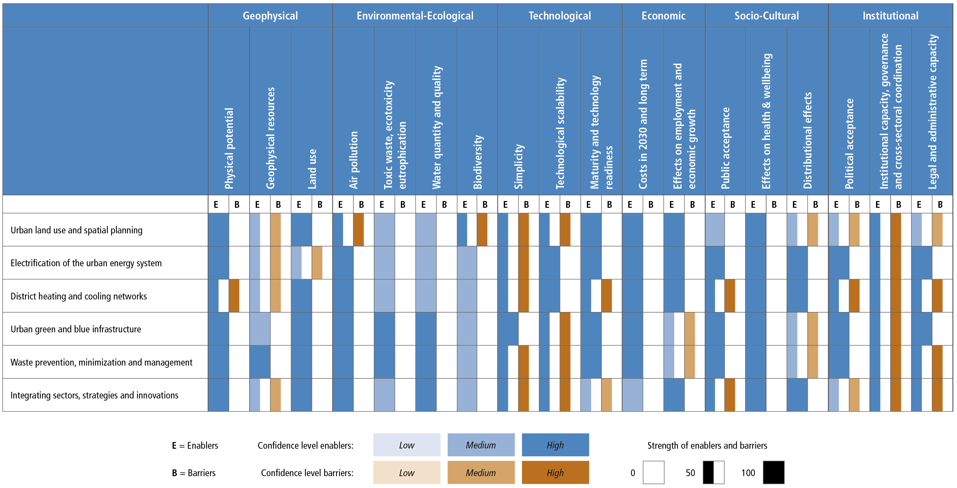
Figure caption
Figure 8.19: Feasibility assessment based on the enablers and barriers of implementing mitigation options for urban systems across multiple dimensions. The figure summarises the extent to which different factors would enable or inhibit the deployment of mitigation options in urban systems. These factors are assessed systematically based on 18 indicators in 6 dimensions (geophysical, environmental-ecological, technological, economic, socio-cultural, and institutional dimensions). Blue bars indicate the extent to which the indicator enables the implementation of the option (E) and orange bars indicate the extent to which an indicator is a barrier (B) to the deployment of the option, relative to the maximum possible barriers and enablers assessed. The shading indicates the level of confidence, with darker shading signifying higher levels of confidence. Supplementary Material 8.SM.2 provides an overview of the extent to which the feasibility of options may differ across context, time and scale of implementation (Table 8.SM.3) and includes line of sight upon which the assessment is based (Table 8.SM.4). The line of sight builds upon urban case studies in (Lamb et al. 2019) and assessments for land use and urban planning (IPCC 2018a) involving 414 references. The assessment method is further explained in Annex II, Section 11.