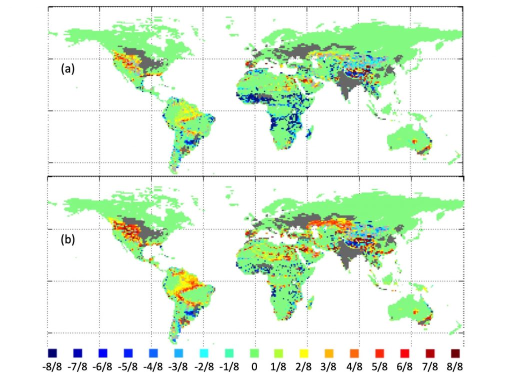
The probability of low-fire regions becoming fire prone (positive values), or of fire-prone areas changing to a low-fire state (negative values) between 1971–2000 and 2071–2100 based on eight-Earth system model (ESM) ensembles, two Shared Socio-economic Pathways (SSPs) and two Representative Concentration Pathways (RCPs). Light grey: areas where at least one ensemble simulation predicts a positive and one a negative change (lack of agreement). Dark grey: area with >50% past or future cropland. Fire-prone areas are defined as having a fire frequency of >0.01 yr-1, (a) RCP4.5 emissions with SSP3 demographics, and (b) RCP8.5 emissions with SSP5 demographics (Knorr et al. 2016a).